Lindsay Blair Howe
2021
Full text
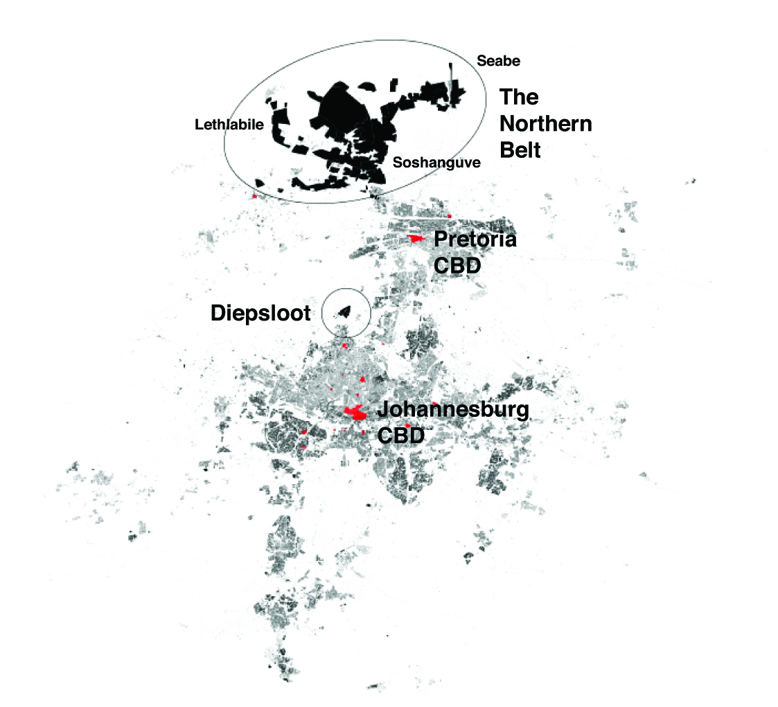
The Gauteng City-Region (GCR) in South Africa is a paradigmatic example of extended urbanization, in which the legacy of mining and apartheid continue to impact spatial practices and the experience of everyday life. The dynamics between urban centralities such as Johannesburg and regional-scale peripheries established by this legacy characterize the «spatiality of poverty» that exists in the GCR today. Yet the relational urbanization processes occurring on these under-researched urban peripheries are also driven by the choices and strategies of people, or «popular agency,» as they negotiate both local and regional-scale spaces in pursuit of opportunities. Utilizing the northern part of the GCR as a case study, the article presents ethnographic research including a purposive sampling of informal settlement residents, government officials, and planning experts to discuss how socio-technical strategies focused on capital expenditure for infrastructure and affordable housing often reinforce existing socio-spatial inequalities. At the same time, new «popular centralities» are emerging as individual people exercise their agency to move around the region and produce alternative forms of space. Considering the agency of people calls for a decentered and transdisciplinary approach to urban analysis and spatial planning, with significant implications for both the theory and practice of urban and regional studies today.