Work in Progress!
Dieser Newsletter ist in der Entstehungsphase, voraussichtliches Versanddatum ist der 20. Juni 2025. Falls Sie diesen und weitere nicht verpassen möchten, klicken Sie bitte oben rechts auf «subscribe».
Dieser Newsletter ist in der Entstehungsphase, voraussichtliches Versanddatum ist der 20. Juni 2025. Falls Sie diesen und weitere nicht verpassen möchten, klicken Sie bitte oben rechts auf «subscribe».
Die Landschaftsarchitektur sieht sich im Kontext des Klimawandels mit neuen Herausforderungen konfrontiert. Mehrheitlich statisch gestaltete Landschaften treffen auf neue, intensivere Dynamiken. Diese Verschiebung erfordert, die Sicht auf Wasserläufe und deren Schwankungen neu zu denken. Um auch in Zukunft robuste Landschaften zu gestalten, beschäftigt sich das Institut für Landschaft und Urbane Studien deshalb mit neuen Entwurfsmethoden.
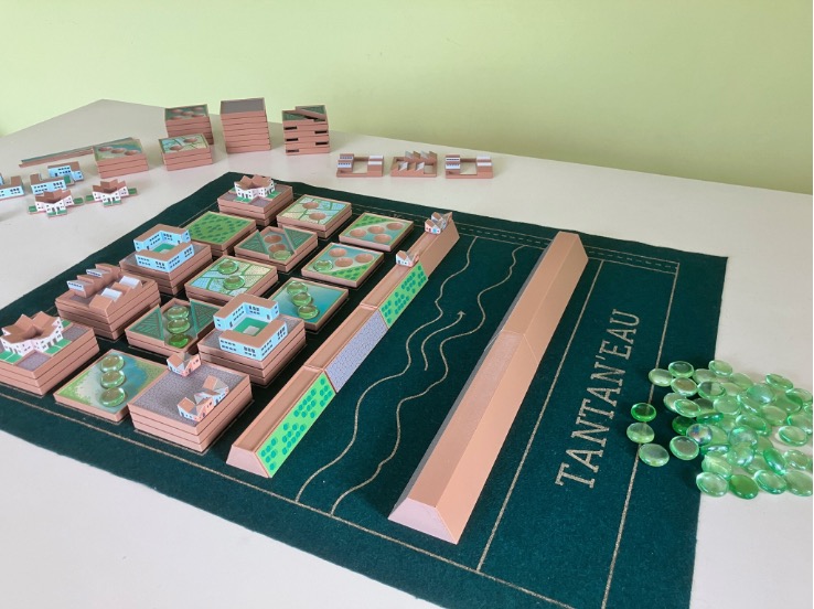
TANTAN’EAU – a wordplay merging «Tantano» (to manage in Malagasy) and «Eau» (water in French) – is a serious game that helps decision-makers explore flood risk management. Designed to balance playability, realism, and the incorporation of architectural propositions, it immerses players in the challenges of peri-urban development in Madagascar’s capital Antananarivo (Tana).
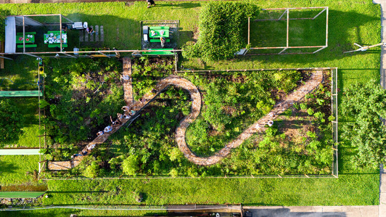
Urban farming and agrarian struggles are reshaping cities and urbanising landscapes. In Zurich and beyond, agroecological initiatives, political food movements, and global urbanisation projects reveal how urban and agrarian worlds are entangled and enmeshed – offering new ways to rethink planning, property, urban ecology, and the future of urbanisation.
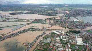
New Orleans is a landscape paradox – a city largely below sea level, which continues to sink as the sea rises outside the levee walls that protect it. Despite its capacity to produce a tremendous amount of biomass and ecological diversity, the city’s urban forest has been in decline since Hurricane Katrina in 2005. In the Garden of the 21st Century New Orleans, we are testing the potential of the Miyawaki method of forest planting to create possibilities for a new type of urban forest in the context of frequent disturbance and climatic precarity.
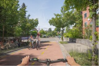
Cities can expand their bike lane networks significantly without causing additional congestion on the roads. That is the conclusion reached by the ETH research project E-Bike City. Project lead and transport researcher Kay Axhausen explains the implications for traffic, the environment and costs.
Article on the ETH News | Article in the Tages-Anzeiger (Paywall)
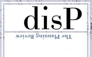
The plan is to (re)position the journal as a key publication in the field of planning. They will build on the long history and high reputation of the journal – as being owned by ETH Zürich / Netzwerk Stadt und Landschaft (NSL), ETH Zürich and having close ties to AESOP – Association of European Schools of Planning – while also increasing its international reach and scholarly impact. disP is a deliberately interdisciplinary, peer-reviewed journal for planning scholarship. Their mission is to publish high quality planning research that integrates important contemporary issues such as urban ecological transitions, socio-spatial justice, digitalisation of planning processes, or democratic participation in planning.
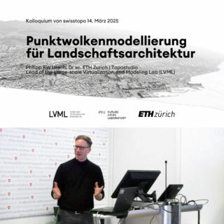
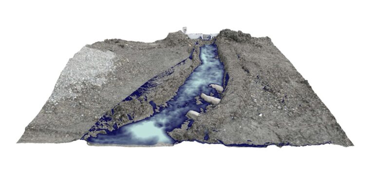
After six years of airborne LiDAR surveys, the classified point cloud of Switzerland – swissSURFACE3D – is now available for the entire Swiss territory. On this occasion, Dr. Philipp Urech presented academic research from the Large-scale Virtualization and Modeling Lab (LVML), complemented by practice-oriented examples of his landscape design approach using precision modelling. The talk was part of the colloquium series of the Swiss Federal Office of Topography. (Slides and recording – at timestamp 1h 08m – are available in German)
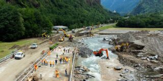
From bridges and tunnels to railways, Switzerland has always invested heavily in the upkeep of its infrastructure. But how does it keep everything operating safely and smoothly while also instilling confidence that nothing will go wrong? Read the full article at ETH News
This is a selection. Find a complete list in the ETH Zürich Research Collection.
As urban environments evolve with increasing complexity, urban planning must adapt by often responding to unsolicited demands rather than to commissioned, structured work. This paper explores the integration of digital tools – including Digital Twins – into the architectural curriculum at ETH Zurich, aiming to bridge the gap between data-driven site analysis and data-driven design.
disP – The Planning Review, Volume 60, Issue 4, December 2024 is now available online on Taylor & Francis Online.

Online Open Doors: 16 June 2025, 12:30-13:00 | Link. The Application Window opens from July 2025. Start: Autumn semester 2025.
Application: 1. June – 30. June 2025 | Duration: September 2025 – January 2026.
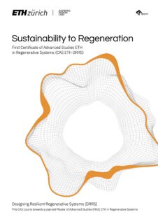
CAS#1 Worldviews: From Sustainability to Regeneration
More
Bewerbung: 1. Mai – 31. Juli 2025 | Dauer: 25. August 2025 – 6. Februar 2026.
More
This is a selection. Head over to our News-Page for more.
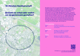
Wir laden Sie herzlich zu unseren Wanderausstellungen «10-Minuten-Nachbarschaften» ein.
10 May – 23 November 2025 | 19th International Architecture Exhibition of La Biennale di Venezia.
Silvia Converso, Institut für Landschaft und Urbane Studien (LUS), Landschaftsarchitektur
Claudia Gebert, Koordinationsstelle NSL, Chefredaktion
Viera Klasovitá, Institut für Verkehrsplanung und Transportsysteme (IVT)
Klearjos Papanicolaou, Institut für Landschaft und Urbane Studien (LUS), Städtebau
Maarten Van Strien, Institut für Raum- und Landschaftsentwicklung (IRL)