Prof. em Christophe Girot | Landscape Architecture
Mapping Power: Landscape Transformation in the Jordan Valley
An interaction of three variables can account for landscape transformation processes at Naharayim/el Baqura over the last century and a half: territory, cartography, and terrain. This interaction is examined across three historical periods marking the passage from nomadism to sedentism: The Ottoman Period (1858-1917), the British Mandate (1918-1948), and the statehood period (1948-1994). Adopting a hybridized and interdisciplinary approach at the interstice of history, landscape architecture and geopolitics, this work performs an in-depth analysis of the three variables in each period and examines their relationship to power.
This work applies a multi-scalar approach to elucidate landscape transformation processes at one geographical site over a defined period. The case study is Naharayim, and the period spans from 1858 to the early 20th century. The work is multidisciplinary in nature, drawing on history, geography, geopolitics, and landscape architecture. The primary methodology is qualitative and relies on three methods: one-on-one interviews, case study research, and qualitative observation. A conceptual framework for the data is provided in the form of a descriptive triangular model comprised of three elements: territory, cartography, and terrain. This model serves to illustrate the impact of human activities on the physical landscape at Naharayim across the period in question.
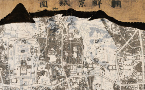
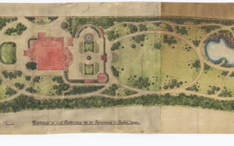
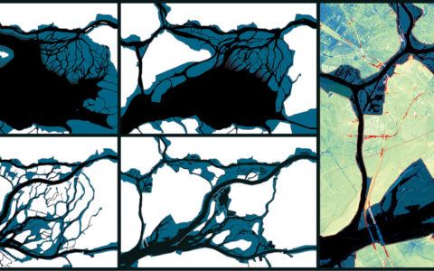
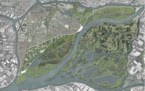
This research will trace the technical development of surveying and landscape drawings of maps while analyzing how these developments interact with the surrounding environment. Mapping as a technical and scientific record was examined chronologically over the last 150 years to illustrate the landscape transformation of the Naharayim site. The practice of compiling and comparing maps across time has been called chronomapping, a method in which a chronological atlas of the Naharayim site was created. In the cartographic technical sources, most research about land properties and land titles focuses on the mapping of private estates and the creation of boundary maps by landowners in relationship with the physical, political, environmental, and cultural aspects of the three historical periods.
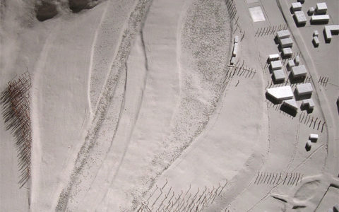
In the corpus of this research, military and infrastructure maps from the classical era to the modern era will be analyzed. Special attention is paid to both large topographic maps and micro-topographical details of the site to understand the effect of large-scale mapping of the territory on the local landscape. Each period is examined through the lens of human activities, such as hydrology, agricultural landscape, infrastructure development and borderlines, all of which contributed to shaping the landscape of the site. In assessing the mutations in this territory, maps will be examined chronographically, which will reveal different landscape features present on this site from the late 19th century to the 21st century.
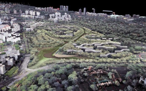
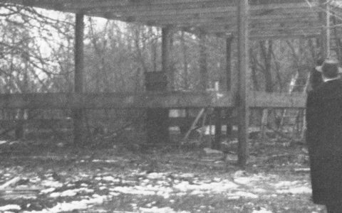
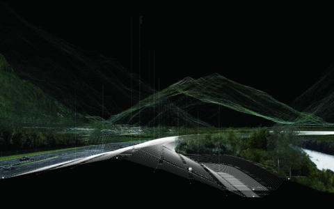
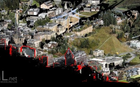
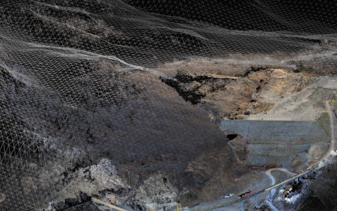
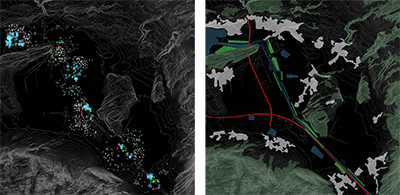
This work also implements fieldwork methodology, including surveying, landscape drawings, and maps in order to provide a detailed understanding of how these interact with the surrounding environment. This method analyzes the physical landscape using Lidar terrestrial laser scanners and modeling techniques developed at the ETH Landscape Visualization and Modelling Lab by the Chair of Landscape Architecture (LVML), Professor Christophe Girot. The field survey has been conducted since 2015 by ETH Department of Architecture in Zurich in collaboration with the Department of Civil Engineering at the Technion in Haifa.
Analyzing the various mapping techniques will allow for a deeper understanding of how cartography has been used as a medium through which landscape was shaped and transformed. Assessing the technical evolution of mapping practices will reveal how human knowledge and mapping development have been important factors in transforming the dynamic natural system of the physical landscape of this site.