Department / Institute: Institute for Spatial and Landscape Development (IRL)
«Das Cern der Stadtplanung werden»
Unter dem Brennglas des Future Cities Lab (FCL) in Singapur werden Probleme greifbar, die gemässigte Zonen wie die Schweiz erst in Zukunft beschäftigen. Das eröffne Chancen, Herausforderungen für Ballungsräume mit fundiertem Wissen anzugehen, meinen Peter Edwards, bisheriger Direktor des ETH-Hubs in Asien, und Gerhard Schmitt, der dessen Leitung More
Davos erfindet sich neu. Vom Lungenkurort zum Kongressstandort
Umgebungsgeräusche für Visualisierungen von Landschaftstypen
Umgebungsgeräusche können dazu beitragen, sich in simulierte Landschaftsszenen besser hineinzuversetzen. Während üblicherweise Umgebungsgeräusche für einen bestimmten Ort aufbereitet werden, ist hier die Frage, welche Umweltgeräusche für einen Landschaftstyp stimmig sind. In einer aktuellen Studie wird deshalb eine Kombination von Hintergrundgeräuschen und sogenannten Soundmarks getestet.
Checnet – Kopplung von anthropogenen und ökologischen Netzwerken für eine nachhaltige Landschafts- und Verkehrsplanung
Anthropogene Netzwerke, bestehend aus Siedlungen und Strassen, sind oft eine Bedrohung für ökologische Netzwerke. Um dafür zu sorgen, dass die Siedlungsentwickelung und die Zunahme des Verkehrs möglichst wenig negative Einflüsse auf die Biodiversität haben, sollen die Bedürfnisse zwischen anthropogenen und ökologischen Netzwerken untersucht und daraus Empfehlungen für die More
MAS, DAS und CAS ETH in Raumplanung 2017/19
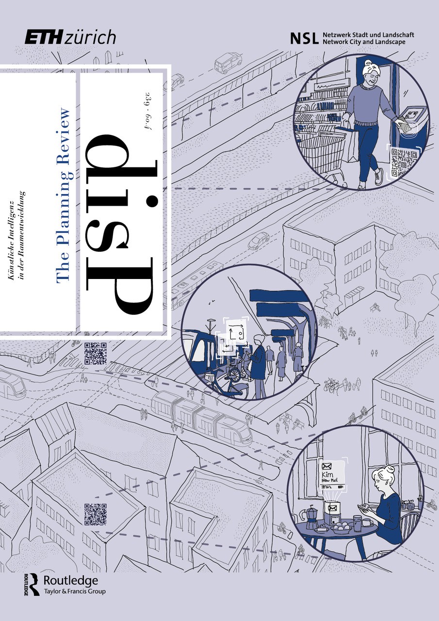
The latest issue of disP – The Planning Review can be found online on our publisher’s website.
Future of Swiss Outdoor Recreation Under Global Change
The Mobility Research Incubator is a transdisciplinary project that brings together researchers from transport planning, social and political sciences, energy systems, and spatial planning at ETH Zürich. As of March 2017, researchers from PLUS investigate the impact of future mobility, anthropogenic climate change and changes in natural climatic More
Development Visions for two Mountain Regions
The MtnPATHS (Pathways for global change adaptation of mountain socio-ecological systems) project kicked off in January 2017, led by Prof. Dr. Adrienne Grêt-Regamey (PLUS, IRL) and Sandra Lavorel (Laboratory of Alpine Ecology, Université Grenoble Alpes). MtnPATHS aims to develop adaptation pathways to achieve specific development visions in two mountain More
Siedlungsmuster als Schlüssel zum Schutz fruchtbarer Böden
Siedlungsausdehnungen orientieren sich sehr stark an bereits bestehenden Siedlungsmustern. Die Fortschreibung vergangener Muster gefährdet aber fruchtbare Böden, da sich diese historisch bedingt in der Nähe bestehender Siedlungen befinden. Um fruchtbare Böden zu schützen, gilt es neue Muster in der Siedlungsausdehnung zu initiieren, unter Einbezug von Daten zur landwirtschaftlichen More
Fachtagung zum Thema Raumentwicklung in Gemeinden (Prof. Dr. Bernd Scholl):
Wie gelingt Innenentwicklung?
Kleine und mittlere Gemeinden besitzen einen Grossteil der Siedlungsreserven, aber oft zu wenig Ressourcen und Know-how, um diese «im Innern» nutzbar zu machen. Gute Siedlungsentwicklung braucht ein Zukunftsbild und eine Strategie. Das Lernen von Beispielen kann dabei hilfreich sein. Artikel auf dem ETH Zukunftsblog von Prof. Bernd Scholl.
Stadtentwicklung Offenbach: Vom Industriehafen zum urbanen Stadtquartier
Tag der Geomatik 2017
Erörterungen zu den Abschlussarbeiten des MAS in Raumplanung
Landschaft in einer neuen Dimension erleben
Spielräume für Dichte. Der Innenentwicklungskompass als problemorientierte Methode für Verdichtung in kleinen und mittleren Gemeinden
Zürich: vdf Verlag. Mehr Mit dem revidierten Raumplanungsgesetz sind Gemeinden verpflichtet, ihre räumliche Entwicklung auf das weitgehend überbaute Gebiet zu lenken. In kleinen und mittleren Gemeinden fehlen jedoch Denkmuster für Innenentwicklung und im Schweizer Mittelland findet ein systematischer «Dichteverzicht» statt. Damit der Transformationsprozess im Hauptsiedlungsraum der Schweiz gelingen kann, More
Filme zu guten Beispielen der Innenentwicklung
Die Professur für Raumentwicklung hat in zahlreichen Gesprächen mit Vertreterinnen und Vertretern aus Gemeinden, Kantonen und dem Bund sowie mit weiteren Fachexpertinnen und -experten schweizweit gute Praxisbeispiele für die Umsetzung der Innenentwicklung in kleinen und mittleren Gemeinden gesucht.
Renewable Energy Infrastructures for Switzerland
The recently started project ENERGYSCAPE develops recommendations serving as a basis for a landscape strategy with a mix of renewable energy systems. The project is part of the NRP 70 «Energy Turnaround» and includes ten different project partners. The focus is on assessing public judgments of the landscape More
Visionierung in der partizipativen Landschaftsentwicklung
Die mangelnde Akzeptanz von räumlichen Planungen resultiert oft aus der unzureichenden Integration relevanter lokaler Akteure, ihrer Bedürfnisse und Wünsche in Planungsprozesse. Durch die Weiterentwicklung der «Landwirtschaftlichen Planung» soll dieses Planungsinstrument des ländlichen Raumes insbesondere um einen Visionierungsprozess erweitert werden. Auf diese Weise werden Planungen auf eine gemeinsam getragene More
Effects of non-aeronautical activities at airports on the public transport access system: A case study of Zurich Airport
In: Journal of Air Transport Management (online 9 September 2014) ISSN 0969-6997. Mehr Non-aeronautical activities at airports generate travellers that have different characteristics than air passengers or airport employees. The study investigated at the case of Zurich airport if this leads to increased public transport ridership, mode share, More
Siedlungsflächenmanagement Schweiz. Problemorientierte Flächenübersichten als zentrale Grundlage für eine Siedlungsentwicklung nach innen
Publikationen des Instituts für Raum- und Landschaftsentwicklung (IRL) der ETH Zürich, Band 7. vdf Hochschulverlag. Mehr Der haushälterische Umgang mit dem Boden kann nur durch ein wirkungsvolles Siedlungsflächenmanagement umgesetzt werden. Was darunter zu verstehen ist und wie die Operationalisierung erfolgen kann, wird in diesem Buch nachgegangen. Basierend auf Ergebnissen More
CODE PELOPONNESE
The Peloponnese Peninsula offers countless attractions for all manner of tourists and travellers: landscapes of exceptional beauty, significant archaeological sites, historical sites and monuments, important cultural events and, especially, agricultural products of high quality. Early in its history, the railway was already a driving force for the economic More
Public Housing Construction as an Opportunity for Inward Development
In 2015, a comprehensive analysis of the public housing inventory in Switzerland was conducted and its potential for a denser internal structure estimated. Starting point was placing public housing apartment buildings in an international context. In 2016, the findings of the nation-wide overview were strengthened based on various More
Capacity of Railway Infrastructure and Possible Density Increases for Future Settlement Development in Central Switzerland
A considerable part of the existing settlement area reserves of around 60% are located in the small and mid-sized communities of Switzerland. The research investigates whether the existing formal and informal planning instruments are suitable for high-quality development according to the minimum strategy of ‘Inward Development before New More
Raum+
The Raum+ project was developed by the Chair of Spatial Development, ETH Zurich and after many years of further development and application in various cantons and regions of Switzerland (AI, BL, FR, GR, OW, SG, SH, SZ, TG, TI, UR, VS), it is now a fully developed and More
Raumplanerisches Entwerfen. Entwerfen als Schlüsselelement von Klärungsprozessen der aktionsorientierten Planung – am Beispiel des regionalen Massstabs
Dissertation, Eidgenössische Technische Hochschule ETH Zürich, Nr. 21100. Mehr PDF Ziel dieser Arbeit ist es, einen Einblick in das Raumplanerische Entwerfen zu geben und für dessen problembezogene Dimension zu werben. Die Ergebnisse werden daher auch im Lichte der bestehenden Prozesse der aktionsorientierten Planung diskutiert, mit dem Ziel, das volle Potenzial More
Der Wert der Natur für Wirtschaft und Gesellschaft
In: Naturkapital Deutschland – TEEB DE. Bonn, Germany. PDF Die Einführungspublikation von „Naturkapital Deutschland“ ist Bestandteil der nationalen Umsetzung der internationalen TEEB-Prozesse. Sie gibt einen Überblick über die Ziele und AkteurInnen des Projekts, gibt Hintergrundinformationen zum gesellschaftlichen und ökonomischen Wert der ökosystemaren Dienstleistungen in Deutschland, erklärt relevante More
Which is the appropriate 3D visualization type for participatory landscape planning workshops? A portfolio of their effectiveness
In: Environment and Planning B, 38: 921-939. Mehr Mehr 3D visualizations have been implemented in workshops and analyzed with regard to their effectiveness as communication tools in planning processes. The results show that the different strengths of both abstract and realistic 3D visualization types are required in participatory workshops.
SAPONI – Spaces and Projects of National Importance
Zürich: vdf Hochschulverlag AG, ETH Zürich. Mehr Over a three years period a series of different symposia with high-level spatial planners from all over Europe had been focusing on strategic spaces and projects. The book sums up the findings of these issues which can have «far-reaching consequences and More
Methodischer Rahmen für den Einsatz von Backcasting zur Anpassung an den Klimawandel
Virtuelle Landschaften zur partizipativen Planung der Landschaftsentwicklung – Einsatz und Nutzen von 3D Landschaftsvisualisierungen in Planungsworkshops
Referierter Tagungsbeitrag zum Forum für Wissen 2010: Landschaftsqualität, WSL, Birmensdorf, Schweiz. S.59-66. PDF Effektive Kommunikation von Landschaftsqualitäten ist grundlegend in partizipativen Workshops zur Landschaftsentwicklung und Visualisierungen können dabei helfen. Diese Publikation zeigt unterschiedliche Stärken von abstrakten und realistischen 3D Visualisierungen als Kommunikationsmittel in unterschiedlichen Workshop-Situationen auf.
Which is the appropriate 3D visualisation type for participatory landscape planning workshops? A portfolio of their effectiveness
submitted. Mehr Kommunikation und Information sind zentrale Aspekte in der partizipativen Planung der Landschaftsentwicklung. Diese Studieanalysiert, wie effizient 3D Landschaftsvisualisierungen zur Kommunikation der räumlichen Information in Planungsworkshops bereits sind.
The Future of Spatial Development in the Limmat Valley
In the final report of the Idea Competition, Perspective for the Spatial Development of the Limmat Valley (PeRL), the participating communities, regions, cantons, Federal representatives and external experts formulated recommendations for possible orientation targets concerning settlement and urban layouts, landscapes and open spaces, mobility and transport and economy More
Spatial and Transport Development in European Corridors: Example Corridor 22, Hamburg-Athens
The Hamburg–Athens Corridor (also called the Orient/East Mediterranean Corridor) is one of Europe’s central north–south transport corridors. It connects the harbours of northern Germany with the Balkan states, the Adriatic harbours, Danube harbours and Mediterranean harbours of Thessaloniki and Athens. Improvements could lead to an increase in railway More
Spatial Development of Small and Mid-sized Communities
Small and mid-sized communities are facing particularly large challenges under the policy of developing existing settlements before expanding into undeveloped or agricultural land. The Chair of Spatial Development is currently working with the community of Lengnau AG in connection to these upcoming tasks. Part of these tasks include More
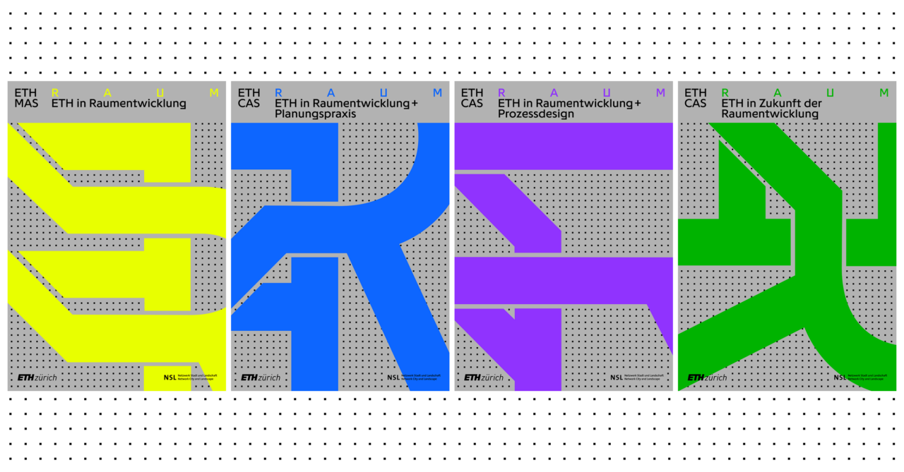
Master of Advanced Studies ETH in Spatial Development
This site is currently unter reconstruction. For current information, please visit the German site.
Designing our Living Spaces
Switzerland is currently facing major challenges in the area of spatial planning. Demographic changes, the need for an internal settlement development to meet the requirements of a continuing population and employment growth, integration of infrastructures, cross-border tasks and others more are important themes of the current discussions. A central concern is a sustainable design and use of our living space. The task for professionals active in spatial planning is to clarify current and future significant problems for cities, communities, regions and the national level and to design solutions that include the processes that belong to it. In addition, the MAS in Spatial Planning ETH Zurich provides a comprehensive and well-founded continuing education at the university level. The central elements of the programme are two interdisciplinary study projects, which help in deepening and applying the knowledge and skills won from lectures and seminars as well as individual study. In addition, the MAS programme is enriched by the exchange of factual knowledge between the quite different disciplines and professional experience of the participants. Lectures by renowned experts from near and far, a study visit and a project in European lands complete the programme.
Programme Duration and Degree
The MAS/CAS Programme takes two years and starts every second Fall Semester. It comprises approximately 880 class hours. A successful completion of the entire programme in spatial planning earns 63 ECTS credit points. The teaching languages are German and English. The title Master of Advanced Studies (MAS) ETH in Spatial Planning will be awarded for the successful completion of the course.
The DAS Programme (30 ECTS) and CAS Programme (10 ECTS) are also on offer as part of the continuing education programme in spatial planning.
Target Group
The MAS/CAS Programme is oriented toward Swiss and foreign professionals with a university degree in fields related to spatial planning, i.e. architecture, geography, engineering, natural science, law, sociology or the humanities, with an emphasis on professional experience in the fields of spatial planning and spatial development.
Admission Requirements
Entrance to the MAS/CAS Programme requires a Master’s degree from an educational institution recognised by ETH or an equivalent educational level and two years of professional experience after completing a degree in a field related to spatial planning.
For information on the application process, go to the MAS/CAS Programme Website.
CH-Eva
Observations and Proposals of the International Experts Group – Commissioned by the Swiss Federal Office of Spatial Development At the request of the Swiss Federal Office of Spatial Development(ARE), an international group of spatial planning experts looked into the current state of Swiss spatial planning and development under More
Test planning for the Borregaard industrial site
The closing of the Borregaard wood processing plant in 2008 left almost 110 hectares, one of the largest industrial brownfields in Switzerland, east of the city of Solothurn available for use. For the Canton of Solothurn, the surrounding region and the local communities, this site holds strategic importance More
Planning Process Studies «Spatial Development of the Lower Reuss Valley»
As part of the development goals of the government programme of 2004-2008 for the Canton of Uri, a broadly applied test planning process was conducted in the Lower Reuss Valley in 2006. Prof. Dr. Scholl served as moderator and scientific advisor of the process. Members of the Chair More
Mapping Urban Ecosystem Services with Google
Researchers in the Future Cities Laboratory at the Singapore-ETH Centre developed a new and relatively inexpensive method to rapidly estimate the amount of shade provided by street trees. Using nearly 100,000 images from Google Street View, the study helps further our understanding on how green spaces contribute to urban sustainability.
Backcasting – Looking Backwards to Reach the Desired Future
Planungsplattform für Hochspannungsleitungen
Um den Planungsprozess von Hochspannungsleitungen zu optimieren, wurde von den Professuren PLUS und GIS gemeinsam mit Industriepartnern eine erweiterbare Web-Plattform entworfen. Diese bietet interaktive und realistische 3D-Landschaftsvisualisierungen für die Beurteilung der Auswirkungen einer neuen Hochspannungsleitung auf das Landschaftsbild und erleichtert damit den Austausch zwischen verschiedenen AkteurInnen. Publikation
Infrastructural Improvements Along the Hamburg–Athens Corridor: A Tool Towards Territorial Cohesion
The Orient/east-Mediterranean corridor has a great potential in terms of strengthening sustainable transportation modes: the North and South European ports should be effectively connected through the enhancement of the railway network, thus raising the freight and passenger capacity and reducing travel times and costs. Moreover, such transnational efforts More
Forschungsbericht: Agglomeration von der Landschaft her denken
Im Auftrag des BAFUs wurde ein Thesenpapier erarbeitet über das Verhältnis von Agglomeration und Landschaft. Darin werden unterschiedliche Sichtweisen auf den Freiraum im Kontext von Agglomerationen analysiert. Das Thesenpapier ist der Versuch, aus einer gestalterischen Perspektive eine Haltung und mögliche Herangehensweisen im Umgang mit Landschaft im urbanen More
Gemeinnütziger Wohnungsbau als Chance zur Innenentwicklung? Zukunftsperspektiven des nicht gewinnorientierten Siedlungsbestandes in der Schweiz
Gemeinnützige Wohnbauträger vermieten in der Schweiz rund 6% aller Wohnungen und leisten einen wichtigen Beitrag für die Versorgung der Bevölkerung mit preisgünstigem Wohnraum. Dieses Forschungsprojekt geht der Frage nach, wie die gemeinnützigen Siedlungsbestände weiterentwickelt werden könnten und fokussiert dabei besonders auf die Zusammenhänge mit der Thematik der Innenentwicklung.
New AudioVisual Lab
The new LVML AudioVisual Lab (AV Lab) offers a surround system for spatial audio-visual simulation of landscape scenarios. It enables students and researchers to investigate how auditory and visual impressions both shape our perception of the environment, through experimental analysis and innovative design approaches. Thereby it complements the infrastructure More
Above vs. Beneath the Surface: What Happens When a Tunnel Solution Fails?
«We want the train as soon as possible!» a participant argued strongly. «We are tired of big promises, lies and mega-projects, such as a tunnel. We want to travel to Athens from the centre of Patras!» another participant continued. «Visitors should experience the city through the train» or More
Soil Quality and Land Use
CHECNET – Wechselwirkungen zwischen anthropogenen und ökologischen Netzwerken
Im Projekt CHECNET des Schweizerischen Nationalfonds SNF werden anthropogene und ökologische Netzwerke im Schweizer Mittelland gekoppelt und die Wechselwirkungen von Infrastruktur und Siedlungen auf natürliche Lebensräume untersucht. Die Resultate sollen Erkenntnisse zur nachhaltigen Entwicklung der Schweiz liefern, insbesondere in den Bereichen Ökologie, Landschafts- und Verkehrsplanung. CHECNET ist eine More