In: Reliability Engineering & System Safety, 162. S.28-39. PDF A non-parametric approach is proposed for qualitative sensitivity analysis (i.e., screening) of dependent inputs. Numerical experiments show that it can properly identify the influential inputs. Its low computational cost but high accuracy makes it practical for the initial screening More
In: Physica A – Statistical Mechanics and Its Applications, 468. S.1-29. PDF This work describes the most important factors influencing walking speed and estimates their impact, based on a review of more than 200 studies that measured walking speed. The parameter values for different influences were computed and More
In the final report of the Idea Competition, Perspective for the Spatial Development of the Limmat Valley (PeRL), the participating communities, regions, cantons, Federal representatives and external experts formulated recommendations for possible orientation targets concerning settlement and urban layouts, landscapes and open spaces, mobility and transport and economy More
The Hamburg–Athens Corridor (also called the Orient/East Mediterranean Corridor) is one of Europe’s central north–south transport corridors. It connects the harbours of northern Germany with the Balkan states, the Adriatic harbours, Danube harbours and Mediterranean harbours of Thessaloniki and Athens. Improvements could lead to an increase in railway More
Small and mid-sized communities are facing particularly large challenges under the policy of developing existing settlements before expanding into undeveloped or agricultural land. The Chair of Spatial Development is currently working with the community of Lengnau AG in connection to these upcoming tasks. Part of these tasks include More
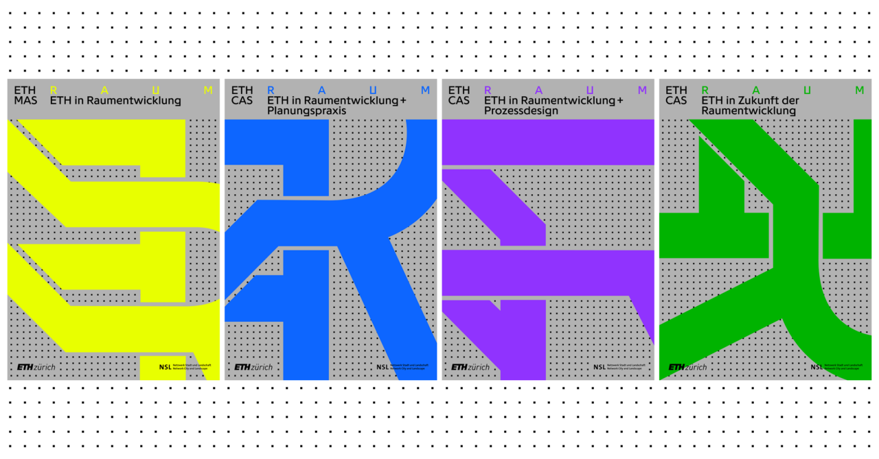
Master of Advanced Studies ETH in Spatial Development
This site is currently unter reconstruction. For current information, please visit the German site.
Designing our Living Spaces
Switzerland is currently facing major challenges in the area of spatial planning. Demographic changes, the need for an internal settlement development to meet the requirements of a continuing population and employment growth, integration of infrastructures, cross-border tasks and others more are important themes of the current discussions. A central concern is a sustainable design and use of our living space. The task for professionals active in spatial planning is to clarify current and future significant problems for cities, communities, regions and the national level and to design solutions that include the processes that belong to it. In addition, the MAS in Spatial Planning ETH Zurich provides a comprehensive and well-founded continuing education at the university level. The central elements of the programme are two interdisciplinary study projects, which help in deepening and applying the knowledge and skills won from lectures and seminars as well as individual study. In addition, the MAS programme is enriched by the exchange of factual knowledge between the quite different disciplines and professional experience of the participants. Lectures by renowned experts from near and far, a study visit and a project in European lands complete the programme.
Programme Duration and Degree
The MAS/CAS Programme takes two years and starts every second Fall Semester. It comprises approximately 880 class hours. A successful completion of the entire programme in spatial planning earns 63 ECTS credit points. The teaching languages are German and English. The title Master of Advanced Studies (MAS) ETH in Spatial Planning will be awarded for the successful completion of the course.
The DAS Programme (30 ECTS) and CAS Programme (10 ECTS) are also on offer as part of the continuing education programme in spatial planning.
Target Group
The MAS/CAS Programme is oriented toward Swiss and foreign professionals with a university degree in fields related to spatial planning, i.e. architecture, geography, engineering, natural science, law, sociology or the humanities, with an emphasis on professional experience in the fields of spatial planning and spatial development.
Admission Requirements
Entrance to the MAS/CAS Programme requires a Master’s degree from an educational institution recognised by ETH or an equivalent educational level and two years of professional experience after completing a degree in a field related to spatial planning.
Observations and Proposals of the International Experts Group – Commissioned by the Swiss Federal Office of Spatial Development At the request of the Swiss Federal Office of Spatial Development(ARE), an international group of spatial planning experts looked into the current state of Swiss spatial planning and development under More
The closing of the Borregaard wood processing plant in 2008 left almost 110 hectares, one of the largest industrial brownfields in Switzerland, east of the city of Solothurn available for use. For the Canton of Solothurn, the surrounding region and the local communities, this site holds strategic importance More
As part of the development goals of the government programme of 2004-2008 for the Canton of Uri, a broadly applied test planning process was conducted in the Lower Reuss Valley in 2006. Prof. Dr. Scholl served as moderator and scientific advisor of the process. Members of the Chair More
Humans engage with their environment in broad, creative ways – not just with cities and houses, but also rivers and lakes, fields and forests. Designing is always embedded in a complex system of influential factors and each design is in turn a part of a historical process. The More
The research project Thesaurus zum Städtebau (Thesaurus on Urban Design) will provide a structured collection of the central building blocks that constitute urban spaces: streets, squares, closes, courtyards, parks, passages and quays. Built upon the contributions of students in the seminar Elemente des städtischen Raumes from the years More
Anlässlich des World Economic Forums 2017 in Davos, an einem Treffen mit Politik, Behörden und Wirtschaftsvertretern aus dem Kanton Graubünden, präsentierte ETH-Präsident Lino Guzzella unter anderem die studentischen Entwürfe einer neuen transalpinen Eisenbahnlinie zwischen Scuol (CH), Mals (IT) und Landeck (A), die im Rahmen des Entwurfssemesters von Marcel Meili, Günther Vogt und More
The subject of this dissertation is the specific symptom-group of Budapest’s post-socialist urban development, planning and governance between 1990 and 2010. Furthermore, it establishes causal nexus between these symptomps and their historical background, namely the charactristics of the socialist past and of the systemic transformation.
Landschaft zu lesen bedeutet, in der Landschaftsarchitektur das Gefüge von geographischen, naturräumlichen oder kulturhistorischen Spuren als Basis für gegenwärtige Formen und zukünftige Gestaltung zu verstehen. Diese Profile aus landschaftlichen «Geschichten» bilden Kernthemen des TheoryLabs der Professur Girot.
Nach dem Versagen der abstrakten Raum- und Stadtplanung ist der Städtebau, genauer: der Stadtentwurf den Planern aus der Hand genommen und von den Architekten und Landschaftsarchitekten besetzt worden. Diese haben ihm, glücklicherweise, seine konkrete und räumliche Dimension zurückgegeben, haben aber den Entwurfsansatz, den sie für Häuser und Gärten More
In collaboration with the Photogrammetry and Laser Scanning Lab at the Technion in Haifa, the DesignLab (Prof. Girot) has been mapping the site of the Jordan River Powerplant at Nahayarim, built in 1932. Using advanced point cloud technology, the site was scanned to achieve a 3D model of More
Seit vielen Jahren schwelt in der Region zwischen dem Unterengadin, dem Oberinntal und dem Vinschgau eine utopische Idee: eine Eisenbahnverbindung zwischen Scuol, Mals und Landeck. Die bestehenden Überlegungen beruhen auf einem langen und teuren Tunnel. Das Studio Meili Vogt Conzett analysierte mit Architekturstudierenden die Möglichkeit einer oberirdischen Linienführung More
Travel demand models constitute a keystone of the economic evaluation of transport projects, facilitating in turn an informed decision making process. In the last decades, travel modelling has evolved along the lines of utilizing more disaggregate data, resulting to computationally cumbersome and conceptually complex models. However, it remains unclear to what extent such models have improved the quality of the evaluation process.
In contemporary airports, traditional notions of infrastructure are questioned. As gateways to metropolitan areas, airports attract new functions and become strategic territories. Eirini Kasioumi’s SNF-funded PhD research Evolving planning strategies in urban airport areas. Case study: the Paris airports explores how changing perceptions of the airport can create tensions More
The Orient/east-Mediterranean corridor has a great potential in terms of strengthening sustainable transportation modes: the North and South European ports should be effectively connected through the enhancement of the railway network, thus raising the freight and passenger capacity and reducing travel times and costs. Moreover, such transnational efforts More
Das DesignLab des Kyoto Institute of Technology lud zum wiederholten Mal das MediaLab der Professur Girot ein, um japanische Gärten in Kyoto mittels Point-Cloud-Scans und 3d-Tonaufnahmen zu erfassen. Im Workshop komponierten japanische Studenten audiovisuelle Sequenzen zur räumlichen Analyse dieser Gärten. Die Ergebnisse des letztjährigen Workshops wurden in der More
Die Städte unserer Erde wachsen rasant. In kürzester Zeit entwickeln sich kleine Dörfer zu Millionenmetropolen. Gewohnt wird Schulter an Schulter und das zu Preisen, die sich Haushalte mit tiefen Einkommen kaum oder gar nicht mehr leisten können. Neue, innovative Wohnbaustrategien scheinen unausweichlich zu sein.
Exploring the political-economic mechanisms underlying the production of affordable housing has been a recurring research theme at the chair of Prof. Marc Angélil. While also addressing the more familiar settings of the United States and central Europe, the main focus has been on rapidly growing urban territories of More
Since 2010, the Professorship of Kees Christiaanse works on the theme of Airports and Cities, investigating urban patterns in airport areas (Better Airport Regions project 2012-2014), or probing visions and discourses connected to airports (PhD research on Paris airports 2014-2017). In 2017, they will publish the book The More
The aerial view allows a vantage point from which to capture photographs, video, and non-visual sensor data of diverse landscape locations. A flexible, fast and simple means of landscape surveying, it has made possible the repeated capture of sites under constant change, whether environmental, cultural, programatic, or land-use.
Seit jeher wird das Gotthardmassiv als das Herz der Alpen verstanden. Stückweise wurde die Landschaft in den vergangenen 150 Jahren durch die Infrastrukturbauten ergänzt. Mit dem neuen Gotthard-Basistunnel verändert sich die Wahrnehmung dieses Raumes erneut. Das interdisziplinäre Forschungsprojekt Gotthard Landscape Infrastructure untersuchte unsere Wahrnehmung dieser für die Schweiz so bedeutsamen Landschaft.
As part of the Scientific & Technological Cooperation Programme Switzerland – Rio de Janeiro (STCPSRJ), the Chair of Prof. Dr. Marc Angélil has launched this three-year research project in January. A joint research between the Institute of Urban Design (ISB) at the Department for Architecture of ETH Zurich and More
The new LVML AudioVisual Lab (AV Lab) offers a surround system for spatial audio-visual simulation of landscape scenarios. It enables students and researchers to investigate how auditory and visual impressions both shape our perception of the environment, through experimental analysis and innovative design approaches. Thereby it complements the infrastructure More
Lifestyle exercise should be a parameter for urban design. A liveable city motivates people to obtain sufficient exercise by doing daily routines. Contemporary inclusive mobility menus encourage urban design geared towards walking and cycling.
Der Mensch ist ein Geomorphic Agent. Als bedeutendster Faktor in den formbildenden Prozessen der Erde bewegen wir heutzutage weit mehr Material als sämtliche natürliche Prozesse zusammen. Die vom Menschen verursachten Erdbewegungen gehören zu den grössten landschaftsplanerischen, gestalterischen und ökologischen Herausforderungen der Zukunft.
Theodor Froebel (1810–1893) und sein Sohn Otto (1844–1906) zählen zu den bedeutendsten Kunst- und Handelsgärtnern der Schweiz des 19. Jahrhunderts. Die kürzlich von Claudia Moll abgeschlossene Dissertation untersucht anhand des Werks der beiden Protagonisten exemplarisch das «Kunstgärtnertum» des 19. Jahrhunderts in der Schweiz. Im Zentrum der Betrachtungen stehen More
Sitting under a tree on a pile of discarded furniture, surrounded by fifteen-story buildings, the sad-eyed farmer and his wife tell a gloomy story, that of disappearing agriculture at the periphery of Cairo. Surrounded on three sides by blind brick facades, their field is about 100 meters long More
Die komplexe Wechselwirkung zwischen Ernährungsform und gebauter Struktur steht im Zentrum von «Urban Food». Die Art und Weise, wie sich Städte ernähren, war und ist bis heute von geografischen, klimatischen und politischen Faktoren abhängig und prägt die Identität des urbanisierten Raumes physisch, ökonomisch und kulturell. Mit der Entwicklung der More
The researchers of the project Landscape Ecology demonstrate that a change of paradigm in river rehabilitation is possible, and provide a future vision that balances concerns over flooding, water quality, and ecology, with the realities of a rapidly growing Southeast Asian city.
What are the mechanisms at work in the production of territory and what are their effects on the make-up of the human habitat? In order to tackle this question, the research focused on the relationship between forms of collective organization (social, political, and economic) and the forms of More
Module IV concentrates on two research topics: 1) Diverse Neighbourhoods: Studying diverse inner city neighbourhoods during their social, economic, cultural and spatial transformation in order to develop policy recommendations and design guidelines. The research focused on case studies in Singapore, Bangkok, Shenzhen and Shanghai. 2) Airport Regions: Investigating the reciprocal urbanization More
Phase 1 of the ETH Future Cities Laboratory ran for five years and comprised 13 research modules, varying from building technology on a micro-scale to territorial explorations on a larger scale. During this time, approximately 100 people were working at the FCL in different cooperative constellations. The successful completion of More
Der neue Bachelorstudiengang, der zusammen mit dem bestehenden MSc Raumentwicklung & Infrastruktursysteme (REIS) einen konsekutiven Studiengang bildet, soll ab Herbstsemester 2017 oder 2018 am D-BAUG eingeführt werden. Das Programm ist in der Praxis sehr gefragt, bietet es doch für die voraussichtlich 35 Absolvierenden pro Jahr einen direkten Zugang zur More
Frank Lloyd Wright, Richard Neutra und andere Architekten der Moderne prägen mit ihren Werken unser architektonisches Denken. Sie zeichnen sich spezifisch aus durch eine sensible Verbindung von Bauwerk und Landschaft. Doch welche konkreten, gestalterischen Elemente fördern eine Wechselwirkung zwischen Innen- und Aussenraum? Und welche entwerferische Haltung steht dahinter? More
Auf der Basis empirischer Untersuchungen in der Metropolitanregion Zürich wurde eine Auswahl relevanter Eigenschaften für zeitgenössische urbane Konstellationen zusammengetragen. Das Urbane Profil integriert diese Aspekte und die ihnen zugrunde liegenden Indikatoren in ein praxisorientiertes Instrumentarium zur strategischen Förderung urbaner Qualitäten. Im Rahmen der laufenden Entwicklungsplanung für die Gemeinden More
Im Rahmen des NFP 65 wurde das Entwerfen nicht nur als Werkzeug zur Imagination neuer Projekte verstanden, sondern auch als eigenständige Wissensform erforscht. Die zentrale These der Untersuchung besagt, dass das Entwerfen als Quelle und Mündung drei verschiedener Dimensionen gedacht werden kann: Als Veränderungsinstrument, als Mittel des Erkenntnisgewinns und als Ausgangslage einer Theorie More
Das Forschungsprojekt Urbane Potentiale und Strategien in metropolitanen Territorien leistet einen qualitativen Beitrag zur aktuellen Stadt- und Raumentwicklungsdebatte in der Schweiz und unterscheidet dabei nicht nach den Kategorien städtisch, suburban oder periurban, sondern entlang von ausgewählten urbanen Qualitäten, die sich aus zahlreichen Untersuchungen konkreter Fallbeispiele in der Metropolitanregion Zürich herauskristallisiert More
Urban rivers facing pressure from rapid urbanisation often take on multiple roles beyond their natural ecological function. The Ciliwung River flows through the megacity of Jakarta and is located in West Java, Indonesia. Along with many rivers in Southeast Asia it has become an environmental buffer to Jakarta’s More
Welche Methoden sind notwendig, um innerhalb des Entwurfprozesses aus der Fülle der vorhandenen Datensätze relevante Informationen zu identifizieren? Wie lassen sich diese Daten visualisieren, um anschliessend aussagekräftige Entscheidungen für den Entwurf ableiten zu können? Dieses Thema erforschen wir experimentell innerhalb des MAS LA Moduls: «Progamming Landscape».
Die Darstellung von Raum auf Karten, Plänen und in Modellen ist so vielfältig, wie es ihre spezifischen Zwecke sind, die Darstellungsformen so variabel wie die Raumwahrnehmung ihrer Autorinnen und Autoren. Im Rahmen der Summer School Mapping Everything setzen sich die Studierenden der Professur Vogt, Landschaftsarchitektur, mit der Kartographierung More
Im Rahmen des NFP 65 Neue Urbane Qualität wurden Eigenschaften einer nachhaltigen urbanen Entwicklung sowie strategische Massnahmen zu deren Stimulierung erarbeitet. Daraus resultierte ein Instrumentarium zur Integration städtebaulicher und sozialwissenschaftlicher Aspekte von Urbanität: Das Urbane Profil. Momentan wird es in Zusammenarbeit mit dem Amt für Raumentwicklung des Kanton More
Städtebauliche Manuale bilden seit der Mitte des 19. Jahrhundert ein zentrales Mittel, um das praktische und theoretische Wissen der Disziplin zusammenzufassen, zu systematisieren und zugänglich zu machen. Inzwischen, nachdem die Wissensfülle in der Disziplin gleichermassen herangewachsen ist, wie die Forderung nach ihrer Integration, bildet die Systematisierung des Wissens More
Gegenstand des geplanten Forschungsprojekts ist die Analyse des städtebautheoretischen Raumdiskurses, der sich ausgehend von der Rezeption von Camillo Sittes Studie Der Städte-Bau nach seinen künstlerischen Grundsätzen aus dem Jahr 1889 im deutschen Sprachraum während des späten 19. und frühen 20. Jahrhunderts entfaltete. Anhand exemplarischer Positionen soll eine vertiefte More
Anlässlich der Verleihung des Zurich Klimapreis 2014 wurde das Projekt Zernez Energia 2020 mit dem mit CHF 10’000 dotierten Sonderpreis ‘Bauten & Wohnen’ ausgezeichnet! Die Jury würdigt den systematischen und ganzheitlichen Ansatz: «Das Projekt berücksichtigt die Schlüsselfaktoren Energieeffizienz, -produktion, -verteilung und -speicherung. Weiter hebt die Jury den zukunftsträchtigen Charakter More
Die moderne elektrische Energieversorgung und ihre Infrastrukturen sind kein statisches System, Veränderungen sind die Normalität. Die Professur für Raumentwicklung des Instituts für Raum- und Landschaftsentwicklung (IRL) setzt sich seit zwei Jahren im Rahmen eines vom Schweizerischen Nationalfonds geförderten Forschungsprojektes mit den Handlungserfordernissen einer integrierten Raum- und Infrastrukturplanung vor More