In: Reliability Engineering & System Safety, 162. S.28-39. PDF A non-parametric approach is proposed for qualitative sensitivity analysis (i.e., screening) of dependent inputs. Numerical experiments show that it can properly identify the influential inputs. Its low computational cost but high accuracy makes it practical for the initial screening Continua
In: Physica A – Statistical Mechanics and Its Applications, 468. S.1-29. PDF This work describes the most important factors influencing walking speed and estimates their impact, based on a review of more than 200 studies that measured walking speed. The parameter values for different influences were computed and Continua
Nel rapporto conclusivo del concorso di idee «Limmat Valley spatial development outlook» («Perspektive Raumentwicklung Limmattal», PeRL) i comuni, le regioni, i cantoni, gli organi della Confederazione e le esperte/gli esperti partecipanti hanno presentato sotto forma di raccomandazioni le possibili strade da seguire nell’ambito degli insediamenti e dell’urbanistica, del Continua
Il corridoio Amburgo-Atene (od Orient/East-Med) è un corridoio di transito da nord a sud centrale per l’Europa. Collega i porti della Germania settentrionale con i Balcani, i porti adriatici, i porti sul Danubio e i porti mediterranei di Salonicco e Atene. Con dei miglioramenti si possono ottenere un aumento delle Continua
I comuni di piccole e medie dimensioni si trovano ad affrontare sfide particolarmente difficili nella realizzazione di uno sviluppo insediativo centripeto. La cattedra si occupa dei compiti correlati a esso sull’esempio del comune di Lengnau AG. Tra questi compiti figura uno sviluppo insediativo centripeto caratterizzato da qualità e Continua
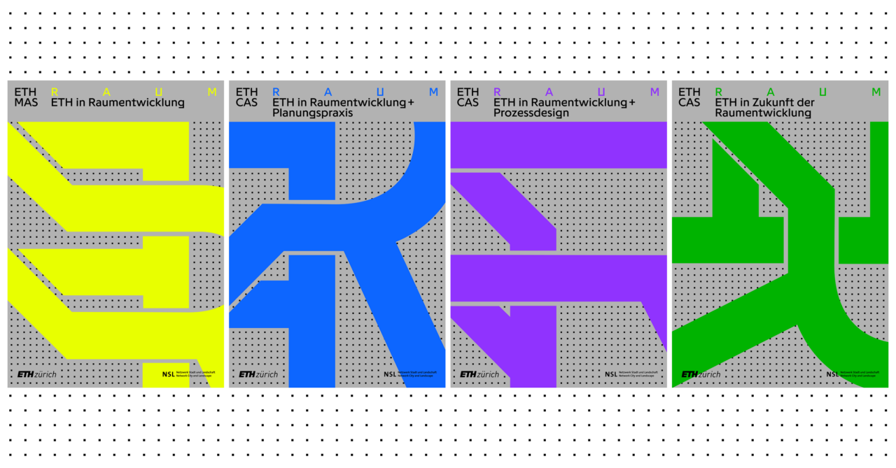
Master of Advanced Studies ETH in Pianificazione del territorio
Questo sito web è in costruzione. Per informazioni aggiornate, consultare la pagina tedesca.
Dare forma al nostro spazio vitale
In materia di pianificazione del territorio, la Svizzera si appresta ad affrontare delle sfide molto impegnative. Cambiamento demografico, sviluppo insediativo centripeto con crescita sostenuta della popolazione e dell’occupazione, integrazione delle infrastrutture, impegni transfrontalieri sono solo alcuni degli aspetti importanti del dibattito attuale. Al centro degli obiettivi ci sono una realizzazione formale e un utilizzo dei nostri spazi vitali che sappiano essere duraturi e sostenibili. Il compito degli esperti di pianificazione del territorio è quello di chiarire, in città e comuni, a livello regionale e a livello nazionale, questioni e problematiche legate a questa disciplina e d’importanza sia attuale che futura, nonché quello di sviluppare soluzioni adeguate con tutti i processi che comportano. In questo senso, il MAS in Pianificazione del territorio dell’ETH di Zurigo offre un ampio e approfondito programma di corsi di specializzazione universitari. Una parte di centrale importanza del corso di studi è rappresentata da due progetti interdisciplinari finalizzati all’applicazione e all’approfondimento delle conoscenze e abilità apprese sia nelle lezioni e seminari che con l’attività di studio personale. Il programma MAS è reso ancora più fecondo dallo scambio di conoscenze specialistiche risultante dall’interdisciplinarità e dalle esperienze professionali dei partecipanti. Integrano l’offerta relazioni di rinomate personalità del settore, sia svizzere che straniere, nonché due escursioni di studio in un altro paese europeo.
Durata e termine del corso di studi
Il programma MAS/CAS ha una durata biennale e inizia ad anni alterni nel semestre autunnale. Le ore di contatto complessive sono 880. A chi assolve con successo il completo programma MAS in Pianificazione del territorio saranno assegnati 63 crediti ECTS. Le lezioni sono tenute in lingua tedesca e/o inglese. A coloro che portano a termine con successo il corso di studi sarà conferito il titolo di Master of Advanced Studies (MAS) ETH in Pianificazione del territorio. La formazione in Pianificazione del territorio è offerta anche come programma DAS (30 ECTS) e come programma CAS (10 ECTS).
Destinatari del programma
Il programma MAS/CAS è destinato a specialisti sia svizzeri che stranieri con formazione universitaria in discipline vicine alla pianificazione del territorio (architettura, geografia, ingegneria, scienze naturali, giurisprudenza, lettere e filosofia, sociologia e altre ancora) e con esperienza professionale nel settore della pianificazione e dello sviluppo del territorio.
Ammissione
Al programma MAS/CAS è ammesso chiunque disponga di una laurea specialistica magistrale (Master) o di un livello di istruzione equivalente riconosciuti dal Politecnico Federale di Zurigo e possa documentare due anni di esperienza professionale successivamente al compimento degli studi in una disciplina vicina alla pianificazione del territorio.
Informazioni sul processo di candidatura sono disponibili sul sito web del programma.
Osservazioni e proposte del gruppo di esperti internazionale – su incarico dell’Ufficio federale dello sviluppo territoriale. Sotto la guida e la direzione del prof. Bernd Scholl, un team internazionale di esperti incaricato dall’Ufficio federale dello sviluppo territoriale (ARE) si è occupato della progettazione e dello sviluppo territoriali svizzeri. Continua
La chiusura della fabbrica di cellulosa nel 2008 ha messo a disposizione, a est della città di Soletta, una delle zone industriali più grandi della Svizzera, formata da circa 110 ettari. Per il Canton Soletta, la regione circostante e i comuni locali, l’area è di importanza strategica per Continua
Nell’ambito degli obiettivi di sviluppo del programma governativo 2004-2008 del Canton Uri, nel 2006 è stata eseguita una pianificazione sperimentale su larga scala nella valle della Reuss inferiore. Il Prof. Dr. Scholl ha presentato il processo e ha ricoperto il ruolo di consulente scientifico. I collaboratori della cattedra Continua
L’uomo interviene in maniera consistente sul proprio ambiente, plasmandolo: non vengono plasmati solo città ed edifici, ma anche fiumi, laghi, prati e boschi. La plasmazione si inserisce sempre all’interno di un complesso sistema di fattori influenti e ogni plasmazione è a sua volta parte di un processo storico. Continua
Con il progetto di ricerca Thesaurus zum Städtebau (Thesaurus di urbanistica) viene creata una raccolta strutturata delle componenti centrali che costituiscono lo spazio urbano: via, piazza, cortile, parco, passaggio e banchina. Partendo dai contributi degli studenti del seminario »Elemente des städtischen Raumes« (Elementi dello spazio urbano) del 2012-2015, Continua
Anlässlich des World Economic Forums 2017 in Davos, an einem Treffen mit Politik, Behörden und Wirtschaftsvertretern aus dem Kanton Graubünden, präsentierte ETH-Präsident Lino Guzzella unter anderem die studentischen Entwürfe einer neuen transalpinen Eisenbahnlinie zwischen Scuol (CH), Mals (IT) und Landeck (A), die im Rahmen des Entwurfssemesters von Marcel Meili, Günther Vogt und Continua
The subject of this dissertation is the specific symptom-group of Budapest’s post-socialist urban development, planning and governance between 1990 and 2010. Furthermore, it establishes causal nexus between these symptomps and their historical background, namely the charactristics of the socialist past and of the systemic transformation.
Landschaft zu lesen bedeutet, in der Landschaftsarchitektur das Gefüge von geographischen, naturräumlichen oder kulturhistorischen Spuren als Basis für gegenwärtige Formen und zukünftige Gestaltung zu verstehen. Diese Profile aus landschaftlichen «Geschichten» bilden Kernthemen des TheoryLabs der Professur Girot.
Nach dem Versagen der abstrakten Raum- und Stadtplanung ist der Städtebau, genauer: der Stadtentwurf den Planern aus der Hand genommen und von den Architekten und Landschaftsarchitekten besetzt worden. Diese haben ihm, glücklicherweise, seine konkrete und räumliche Dimension zurückgegeben, haben aber den Entwurfsansatz, den sie für Häuser und Gärten Continua
In collaboration with the Photogrammetry and Laser Scanning Lab at the Technion in Haifa, the DesignLab (Prof. Girot) has been mapping the site of the Jordan River Powerplant at Nahayarim, built in 1932. Using advanced point cloud technology, the site was scanned to achieve a 3D model of Continua
Seit vielen Jahren schwelt in der Region zwischen dem Unterengadin, dem Oberinntal und dem Vinschgau eine utopische Idee: eine Eisenbahnverbindung zwischen Scuol, Mals und Landeck. Die bestehenden Überlegungen beruhen auf einem langen und teuren Tunnel. Das Studio Meili Vogt Conzett analysierte mit Architekturstudierenden die Möglichkeit einer oberirdischen Linienführung Continua
Travel demand models constitute a keystone of the economic evaluation of transport projects, facilitating in turn an informed decision making process. In the last decades, travel modelling has evolved along the lines of utilizing more disaggregate data, resulting to computationally cumbersome and conceptually complex models. However, it remains unclear to what extent such models have improved the quality of the evaluation process.
In contemporary airports, traditional notions of infrastructure are questioned. As gateways to metropolitan areas, airports attract new functions and become strategic territories. Eirini Kasioumi’s SNF-funded PhD research Evolving planning strategies in urban airport areas. Case study: the Paris airports explores how changing perceptions of the airport can create tensions Continua
The Orient/east-Mediterranean corridor has a great potential in terms of strengthening sustainable transportation modes: the North and South European ports should be effectively connected through the enhancement of the railway network, thus raising the freight and passenger capacity and reducing travel times and costs. Moreover, such transnational efforts Continua
Das DesignLab des Kyoto Institute of Technology lud zum wiederholten Mal das MediaLab der Professur Girot ein, um japanische Gärten in Kyoto mittels Point-Cloud-Scans und 3d-Tonaufnahmen zu erfassen. Im Workshop komponierten japanische Studenten audiovisuelle Sequenzen zur räumlichen Analyse dieser Gärten. Die Ergebnisse des letztjährigen Workshops wurden in der Continua
Die Städte unserer Erde wachsen rasant. In kürzester Zeit entwickeln sich kleine Dörfer zu Millionenmetropolen. Gewohnt wird Schulter an Schulter und das zu Preisen, die sich Haushalte mit tiefen Einkommen kaum oder gar nicht mehr leisten können. Neue, innovative Wohnbaustrategien scheinen unausweichlich zu sein.
Exploring the political-economic mechanisms underlying the production of affordable housing has been a recurring research theme at the chair of Prof. Marc Angélil. While also addressing the more familiar settings of the United States and central Europe, the main focus has been on rapidly growing urban territories of Continua
Since 2010, the Professorship of Kees Christiaanse works on the theme of Airports and Cities, investigating urban patterns in airport areas (Better Airport Regions project 2012-2014), or probing visions and discourses connected to airports (PhD research on Paris airports 2014-2017). In 2017, they will publish the book The Continua
The aerial view allows a vantage point from which to capture photographs, video, and non-visual sensor data of diverse landscape locations. A flexible, fast and simple means of landscape surveying, it has made possible the repeated capture of sites under constant change, whether environmental, cultural, programatic, or land-use.
Seit jeher wird das Gotthardmassiv als das Herz der Alpen verstanden. Stückweise wurde die Landschaft in den vergangenen 150 Jahren durch die Infrastrukturbauten ergänzt. Mit dem neuen Gotthard-Basistunnel verändert sich die Wahrnehmung dieses Raumes erneut. Das interdisziplinäre Forschungsprojekt Gotthard Landscape Infrastructure untersuchte unsere Wahrnehmung dieser für die Schweiz so bedeutsamen Landschaft.
As part of the Scientific & Technological Cooperation Programme Switzerland – Rio de Janeiro (STCPSRJ), the Chair of Prof. Dr. Marc Angélil has launched this three-year research project in January. A joint research between the Institute of Urban Design (ISB) at the Department for Architecture of ETH Zurich and Continua
The new LVML AudioVisual Lab (AV Lab) offers a surround system for spatial audio-visual simulation of landscape scenarios. It enables students and researchers to investigate how auditory and visual impressions both shape our perception of the environment, through experimental analysis and innovative design approaches. Thereby it complements the infrastructure Continua
Lifestyle exercise should be a parameter for urban design. A liveable city motivates people to obtain sufficient exercise by doing daily routines. Contemporary inclusive mobility menus encourage urban design geared towards walking and cycling.
Der Mensch ist ein Geomorphic Agent. Als bedeutendster Faktor in den formbildenden Prozessen der Erde bewegen wir heutzutage weit mehr Material als sämtliche natürliche Prozesse zusammen. Die vom Menschen verursachten Erdbewegungen gehören zu den grössten landschaftsplanerischen, gestalterischen und ökologischen Herausforderungen der Zukunft.
Theodor Froebel (1810–1893) und sein Sohn Otto (1844–1906) zählen zu den bedeutendsten Kunst- und Handelsgärtnern der Schweiz des 19. Jahrhunderts. Die kürzlich von Claudia Moll abgeschlossene Dissertation untersucht anhand des Werks der beiden Protagonisten exemplarisch das «Kunstgärtnertum» des 19. Jahrhunderts in der Schweiz. Im Zentrum der Betrachtungen stehen Continua
Sitting under a tree on a pile of discarded furniture, surrounded by fifteen-story buildings, the sad-eyed farmer and his wife tell a gloomy story, that of disappearing agriculture at the periphery of Cairo. Surrounded on three sides by blind brick facades, their field is about 100 meters long Continua
Die komplexe Wechselwirkung zwischen Ernährungsform und gebauter Struktur steht im Zentrum von «Urban Food». Die Art und Weise, wie sich Städte ernähren, war und ist bis heute von geografischen, klimatischen und politischen Faktoren abhängig und prägt die Identität des urbanisierten Raumes physisch, ökonomisch und kulturell. Mit der Entwicklung der Continua
The researchers of the project Landscape Ecology demonstrate that a change of paradigm in river rehabilitation is possible, and provide a future vision that balances concerns over flooding, water quality, and ecology, with the realities of a rapidly growing Southeast Asian city.
What are the mechanisms at work in the production of territory and what are their effects on the make-up of the human habitat? In order to tackle this question, the research focused on the relationship between forms of collective organization (social, political, and economic) and the forms of Continua
Module IV concentrates on two research topics: 1) Diverse Neighbourhoods: Studying diverse inner city neighbourhoods during their social, economic, cultural and spatial transformation in order to develop policy recommendations and design guidelines. The research focused on case studies in Singapore, Bangkok, Shenzhen and Shanghai. 2) Airport Regions: Investigating the reciprocal urbanization Continua
Phase 1 of the ETH Future Cities Laboratory ran for five years and comprised 13 research modules, varying from building technology on a micro-scale to territorial explorations on a larger scale. During this time, approximately 100 people were working at the FCL in different cooperative constellations. The successful completion of Continua
Der neue Bachelorstudiengang, der zusammen mit dem bestehenden MSc Raumentwicklung & Infrastruktursysteme (REIS) einen konsekutiven Studiengang bildet, soll ab Herbstsemester 2017 oder 2018 am D-BAUG eingeführt werden. Das Programm ist in der Praxis sehr gefragt, bietet es doch für die voraussichtlich 35 Absolvierenden pro Jahr einen direkten Zugang zur Continua
Frank Lloyd Wright, Richard Neutra und andere Architekten der Moderne prägen mit ihren Werken unser architektonisches Denken. Sie zeichnen sich spezifisch aus durch eine sensible Verbindung von Bauwerk und Landschaft. Doch welche konkreten, gestalterischen Elemente fördern eine Wechselwirkung zwischen Innen- und Aussenraum? Und welche entwerferische Haltung steht dahinter? Continua
Auf der Basis empirischer Untersuchungen in der Metropolitanregion Zürich wurde eine Auswahl relevanter Eigenschaften für zeitgenössische urbane Konstellationen zusammengetragen. Das Urbane Profil integriert diese Aspekte und die ihnen zugrunde liegenden Indikatoren in ein praxisorientiertes Instrumentarium zur strategischen Förderung urbaner Qualitäten. Im Rahmen der laufenden Entwicklungsplanung für die Gemeinden Continua
Im Rahmen des NFP 65 wurde das Entwerfen nicht nur als Werkzeug zur Imagination neuer Projekte verstanden, sondern auch als eigenständige Wissensform erforscht. Die zentrale These der Untersuchung besagt, dass das Entwerfen als Quelle und Mündung drei verschiedener Dimensionen gedacht werden kann: Als Veränderungsinstrument, als Mittel des Erkenntnisgewinns und als Ausgangslage einer Theorie Continua
Das Forschungsprojekt Urbane Potentiale und Strategien in metropolitanen Territorien leistet einen qualitativen Beitrag zur aktuellen Stadt- und Raumentwicklungsdebatte in der Schweiz und unterscheidet dabei nicht nach den Kategorien städtisch, suburban oder periurban, sondern entlang von ausgewählten urbanen Qualitäten, die sich aus zahlreichen Untersuchungen konkreter Fallbeispiele in der Metropolitanregion Zürich herauskristallisiert Continua
Urban rivers facing pressure from rapid urbanisation often take on multiple roles beyond their natural ecological function. The Ciliwung River flows through the megacity of Jakarta and is located in West Java, Indonesia. Along with many rivers in Southeast Asia it has become an environmental buffer to Jakarta’s Continua
Welche Methoden sind notwendig, um innerhalb des Entwurfprozesses aus der Fülle der vorhandenen Datensätze relevante Informationen zu identifizieren? Wie lassen sich diese Daten visualisieren, um anschliessend aussagekräftige Entscheidungen für den Entwurf ableiten zu können? Dieses Thema erforschen wir experimentell innerhalb des MAS LA Moduls: «Progamming Landscape».
Die Darstellung von Raum auf Karten, Plänen und in Modellen ist so vielfältig, wie es ihre spezifischen Zwecke sind, die Darstellungsformen so variabel wie die Raumwahrnehmung ihrer Autorinnen und Autoren. Im Rahmen der Summer School Mapping Everything setzen sich die Studierenden der Professur Vogt, Landschaftsarchitektur, mit der Kartographierung Continua
Im Rahmen des NFP 65 Neue Urbane Qualität wurden Eigenschaften einer nachhaltigen urbanen Entwicklung sowie strategische Massnahmen zu deren Stimulierung erarbeitet. Daraus resultierte ein Instrumentarium zur Integration städtebaulicher und sozialwissenschaftlicher Aspekte von Urbanität: Das Urbane Profil. Momentan wird es in Zusammenarbeit mit dem Amt für Raumentwicklung des Kanton Continua
Städtebauliche Manuale bilden seit der Mitte des 19. Jahrhundert ein zentrales Mittel, um das praktische und theoretische Wissen der Disziplin zusammenzufassen, zu systematisieren und zugänglich zu machen. Inzwischen, nachdem die Wissensfülle in der Disziplin gleichermassen herangewachsen ist, wie die Forderung nach ihrer Integration, bildet die Systematisierung des Wissens Continua
Gegenstand des geplanten Forschungsprojekts ist die Analyse des städtebautheoretischen Raumdiskurses, der sich ausgehend von der Rezeption von Camillo Sittes Studie Der Städte-Bau nach seinen künstlerischen Grundsätzen aus dem Jahr 1889 im deutschen Sprachraum während des späten 19. und frühen 20. Jahrhunderts entfaltete. Anhand exemplarischer Positionen soll eine vertiefte Continua
Anlässlich der Verleihung des Zurich Klimapreis 2014 wurde das Projekt Zernez Energia 2020 mit dem mit CHF 10’000 dotierten Sonderpreis ‘Bauten & Wohnen’ ausgezeichnet! Die Jury würdigt den systematischen und ganzheitlichen Ansatz: «Das Projekt berücksichtigt die Schlüsselfaktoren Energieeffizienz, -produktion, -verteilung und -speicherung. Weiter hebt die Jury den zukunftsträchtigen Charakter Continua
Die moderne elektrische Energieversorgung und ihre Infrastrukturen sind kein statisches System, Veränderungen sind die Normalität. Die Professur für Raumentwicklung des Instituts für Raum- und Landschaftsentwicklung (IRL) setzt sich seit zwei Jahren im Rahmen eines vom Schweizerischen Nationalfonds geförderten Forschungsprojektes mit den Handlungserfordernissen einer integrierten Raum- und Infrastrukturplanung vor Continua