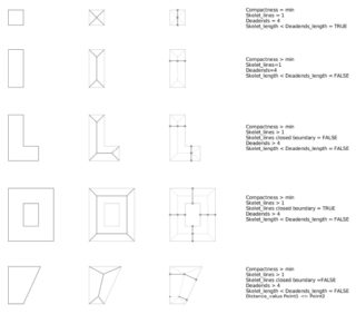
A multiscale classification of the urban morphology
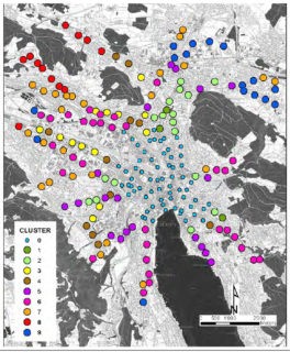
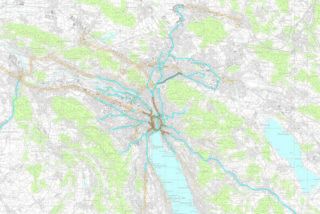
Paper presented at the World Symposium on Transport and Land Use Research (WSTLUR), Delft. June 2014. Mehr The urban morphology forms the backbone of our settlements. Its quantitative description allows to compare urban layouts and to uncover their potentials and limitations. In this paper we propose a set More
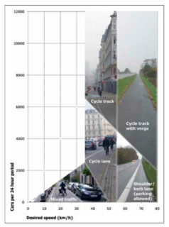
Verkehrsqualität und Leistungsfähigkeit von Anlagen des leichten Zweirad- und des Fussgängerverkehrs
Forschungsauftrag VSS, 2007/306, Bundesamt für Strassen, Bern. PDF Die Forschungsarbeit hat Normierungsvorschläge zur Leistungsfähigkeit und Verkehrsqualität für die wichtigsten Anlagen des leichten Zweirad- und Fussgängerverkehrs erarbeitet. Sie stellt damit einen wichtigen Beitrag zur Entwicklung von verkehrsmittelübergreifenden Beurteilungsverfahren dar.
Stadtregionen planen | Stadsregio’s plannen
Strategien und Instrumente des Städtebaus: Ein Vergleich von Amsterdam und Zürich | Strategieën en instrumenten van de stedenbouw: een vergelijking tussen Amsterdam en Zürich. Hochparterre Sonderheft. Mehr Amsterdam und Zürich sind Stadtregionen unter Wachstumsdruck. Wie können sie ihre räumliche Entwicklung sinnvoll und effizient steuern? Das Heft liefert Antworten aus Theorie und More
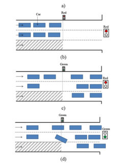
Evaluation of pre-signals at oversaturated signalized
Transportation Research Record. PDF ECitation One of the major causes of bus delays in urban environments are signalized intersections. The use of a pre-signal has been proposed in order to utilize the full capacity of the main signal while still providing bus priority. The goal of this research More
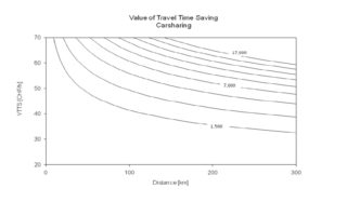
Modeling station-based carsharing in Switzerland
Paper presented at the 14th Swiss Transport Research Conference, Ascona, May 2014. PDF Carsharing use has grown significantly in recent years, partly because of the expansion of the carsharing alternatives offered. From a modelling perspective, the main challenge is to develop suitable models for simulating different carsharing options. More
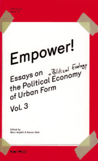
Empower!
Ruby Press. More Hot off the press! Featuring essays by Paulo Tavares, Keller Easterling, Matias Echanove and Rahul Srivastava of URBZ, and Rainer Hehl. Empower is the third volume in the «Essays on the Political Economy of Urban Form» series, this time adding a touch of political ecology.
Modeling impacts of weather conditions in agent-based transport microsimulations
Paper presented at the 93rd Annual Meeting of the Transportation Research Board, Washington, D.C., January 2014. PDF Despite all mitigation efforts, climate change will impact transport systems. Based on evidence from previous literature, a new comprehensive classification of the transport system aspects affected by climate change is proposed. It’s More
Prognose der Dauer von Störungen des Bahnbetriebs
Dissertation, IVT-Schriftenreihe Nr. 164. Mehr Die Spurgebundenheit der Bahnsysteme bewirkt eine komplexe Betriebsführung. Im Ereignisfall bietet die Prognose der Störungsdauer Nutzen für die Bahnproduktion. Darüber hinaus wurden Disposition, Intervention und Ereigniskommunikation analysiert. Die Kombination aus statistischen Analysen und prozessualen Aspekten ermöglicht die Einbindung konkreter Einzelinformationen in den Prognoseprozess.
Anthologie zum Städtebau, Bd. 2 (in 2 Teilbd.): Das Phänomen Großstadt und die Entstehung der Stadt der Moderne
Berlin. PDF Nun vollständig vorliegend: Das große Kompendium der modernen Städtebautheorie, das ihre historische Entwicklung vom 18. Jahrhundert bis heute erstmals als zusammenhängenden Diskurs nachvollziehbar macht. Band I. Von der Stadt der Aufklärung zur Metropole des industriellen Zeitalters, Berlin: Gebr. Mann Verlag, 2008. Band III. Vom Wiederaufbau nach dem More
SLUM Lab: Empower Shack.
PDF Mehr The Empower Shack team is a response to unsustainable housing approaches in South Africa. What began as a design and build workshop, aimed at developing a double-story shack prototype for Cape Town’s Khayelitsha township, has evolved into a more ambitious project to implement design innovations for rapid and More
Topical Thoughts on the Contemporary Landscape
Landscript 3. TOPOLOGY. Mehr There is a schism between the way landscape is understood scientifically and the way the same place exists emotionally. This disparity calls for a change of approach. Topology can pay greater attention to deeper spatial, physical, poetic and philosophical values embedded in a long More
Methodik zur Effizienzbeurteilung der Kapazitätsnutzung und -entwicklung von Bahnnetzen
Dissertation, IVT-Schriftenreihe Nr. 163. Mehr Im Rahmen der Dissertation wurde bewiesen, dass es methodisch möglich ist, bereits in einem frühen Projektstadium eine konsistente Kapazitätsbeurteilung und Effizienzabschätzung von Erweiterungsmassnahmen durchzuführen. Besondere Berücksichtigung fand dabei das Spannungsfeld zwischen den Anforderungen der Netznutzenden einerseits und einer optimalen Netzauslastung andererseits.
Grossräumige Evakuierung – Agenten-basierte Analyse
Schlussbericht an das BABS, Bern. Zürich: IVT, ETH Zürich. PDF Mittels eines agenten-basierten Simulationsmodells wurden die zu erwartenden Evakuationszeiten im Falle einer grossräumigen Evakuierung in Abhängigkeit verschiedener Faktoren wie Uhrzeit, Strassenverhältnissen und Grösse des evakuierten Gebietes bestimmt. Grundlage der Verhaltensmodellierung bildeten eine ausführliche Literaturrecherche, Experteninterviews sowie eine Befragung der Schweizer More
Methodology to Evaluate Cost and Accuracy of Parking Patrol Surveys
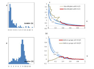
Transportation Research Record, 2359, 1-9. Mehr Parking duration is an important element in reflecting the parking demand, very often a patrol survey is conducted to obtain the data. This paper introduces an analytical model to understand the effects of survey cost and other inputs on survey accuracy in a More
Understanding metropolitan patterns of daily encounters
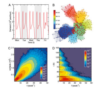
PNAS. Mehr With the help of travel smart card data, we uncover daily face-to-face encounter mechanisms and structures by constructing a time-resolved in-vehicle social encounter network on public buses. We find individuals with repeated encounters are not grouped into small communities. A large, imperceptible, small-world contact network is More
Raumplanerisches Entwerfen. Entwerfen als Schlüsselelement von Klärungsprozessen der aktionsorientierten Planung – am Beispiel des regionalen Massstabs
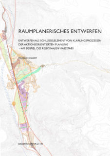
Dissertation, Eidgenössische Technische Hochschule ETH Zürich, Nr. 21100. Mehr PDF Ziel dieser Arbeit ist es, einen Einblick in das Raumplanerische Entwerfen zu geben und für dessen problembezogene Dimension zu werben. Die Ergebnisse werden daher auch im Lichte der bestehenden Prozesse der aktionsorientierten Planung diskutiert, mit dem Ziel, das volle Potenzial More
Techno-Pastoral Fantasies at Hong Kong International Airport
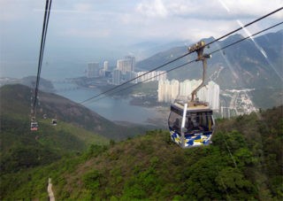
Places/Design Observer. July 2013. Mehr In the past 20 years Hong Kong has shed its roots as a colonial trading hub and emerged as a global financial center, a transition enabled by massive investments in infrastructure and land reclamation. The most dramatic of these endeavors comprised the construction More
Decision support tools in transport planning: from research to practice
Paper presented at the 13th Swiss Transport Research Conference, Ascona, April 2013. Mehr In this paper, we present a framework of a decision support system designed to analyse information provided by agent-based transport demand models, travel diary surveys and automatically collected data on transport infrastructure usage. The practical More
Assessing changes in travel behaviour induced by modified travel times: A stated adaptation survey and modelling approach
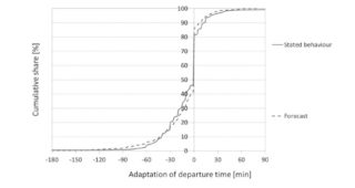
In: disP, 48 (3) S.40-53. Mehr Respondents to a stated adaptation survey were faced with scenarios in which their travel conditions were changed, and asked how the implied changes would affect their activity scheduling. The data was used to estimate models of adaptations, which yielded sparse reactions despite More
Differences in cognition of public transport systems: Image and behavior towards urban public transport
chriftenreihe des IVT, 162. Zürich: Institut für Verkehrsplanung und Transportsysteme, ETH Zürich. Mehr Der Schienenbonus als Vermutung, dass verschiedene Verkehrsmittel diverse Nachfragewirkungen erzielen, kann mit dieser Dissertation für den Fall Bus und Tram in der Schweiz nicht bestätigt werden. Es ist zu erwarten, dass ein Bussystem bei gleichen More
From Camp to City. Refugee Camps of the Western Sahara
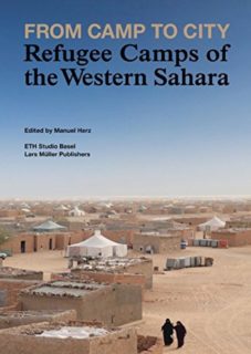
ETH Studio Basel; Lars Müller Publishers. Mehr Das Thema von Flüchtlingslagern im Kontext von Stadtentwicklung und Architektur untersuchend, stellt das Buch eine intensive Dokumentation eines urbanen Grenzfalles sahrawischer Flüchtlingslager dar, die sich in der algerischen Wüste im Laufe von 35 Jahren verstetigt haben. Das Buch zeigt, wie die More
Cidade De Deus – City of God: working with informalized mass housing in Brazil
Ruby Press. Mehr Rio de Janeiro serves as the inspiration and case study for this publication, a widely relevant study of the appropriation and customization of standardized mass housing over time.
Productivity improvements for freight railways through collaborative transport planning
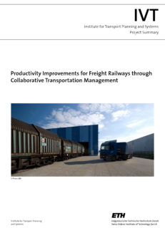
Dissertation, IVT-Schriftenreihe Nr. 160. ISBN 978-3-90826-24-1. Mehr Der Schienengüterverkehr sieht sich angesichts des intermodalen Wettbewerbsdrucks einer stetigen Gratwanderung zwischen flexiblen Transportlösungen und einer genügend hohen Produktivität gegenüber. Am Beispiel der schweizerischen Güterverkehrsmärkte Mineralöl, Kies und Schrott werden unterschiedliche Formen operativer Kooperationen zwischen den Güterbahnen aufgezeigt und erörtert.
Der Wert der Natur für Wirtschaft und Gesellschaft
In: Naturkapital Deutschland – TEEB DE. Bonn, Germany. PDF Die Einführungspublikation von „Naturkapital Deutschland“ ist Bestandteil der nationalen Umsetzung der internationalen TEEB-Prozesse. Sie gibt einen Überblick über die Ziele und AkteurInnen des Projekts, gibt Hintergrundinformationen zum gesellschaftlichen und ökonomischen Wert der ökosystemaren Dienstleistungen in Deutschland, erklärt relevante More
Topologie/Topology
Pamphlet 15 (Publikationsreihe der Professur Christophe Girot). Zürich. Mehr Die Gestaltungsaufgaben in der Landschaftsarchitektur haben sich grundlegend geändert. Doch welche Parameter sind den aktuellen Gegebenheiten angemessen? Unter dem Begriff «Topologie» bezieht die Professur von Christophe Girot Position. Die Landschaftsarchitektur soll als integrative Disziplin mit einer tief verankerten More
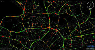
A multi-model approach to large-scale multiagent transport simulation
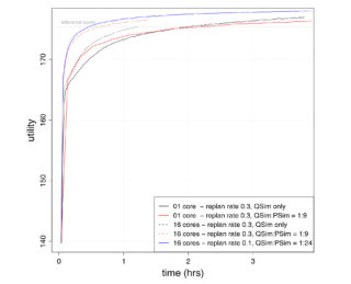
Arbeitsberichte Verkehrs- und Raumplanung, 793. Zürich: IVT, ETH Zürich. Mehr We introduce a simple meta-model to the MATSim framework that modifies and evaluates new plans before execution. The method speeds up linearly with increasing computational cores, and reduces the number of queue simulations required to achieve a relaxed More
Torre David. Informal Vertical Communities
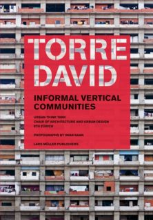
Zürich: Lars Müller Publishers. Urban-Think Tank, Lehrstuhl für Architektur und Städtebau, ETH Zürich. Fotografien von Iwan Baan. Mehr Torre David, a 45-story skyscraper in Caracas, has remained uncompleted since the Venezuelan economy collapsed in 1994. Today, it is the improvised home to more than 750 families living in More
Metro/tram: Eine Perspektive für Zürich
157, Schriftenreihe IVT, Zürich. Mehr Um den Herausforderungen der weiter aufstrebenden Aggolomeration Zürich Rechnung zu tragen, schlagen Prof. Dr. Ulrich Weidmann (IVT) und Werner Huber (Verlag Hochparterre) eine Aufwertung des bestehenden Stadtzürcher Tramnetzes zum Metrotram vor. Der Bericht zeichnet eine Vision urbaner Mobilität in einer Kombination von Verkehrsplanung More
Development of psychometric scales to evaluate the attitude towards risk, environmentalism and variety seeking of public transport users
Transportation Research Record. Mehr In the transport modelling community, there is a growing consensus that attitudes of travellers have to be taken into account. Though it is not possible to measure attitudes directly, psychometric scales can be used as indicators. The paper presents psychometric scales for environmentalism and More
Der Stoclet-Fries. Ein künstlicher Garten im Herzen des Hauses
In: Tobias Natter (Hrsg.): Gustav Klimt. Sämtliche Gemälde, Köln, S.100-187 (in Deutsch, Englisch, Italienisch, Französisch). Mehr Der Aufsatz untersucht das Zusammenspiel des Mosaikfrieses von Gustav Klimt im Speisesaal des Palais Stoclet mit der Architektur von Josef Hoffmann und dem Garten. Das Ensemble wurde 2009 Unesco Weltkulturerbe. Anette Freytag More
A dynamic cordon pricing scheme combining a macroscopic and an agent-based traffic model
In: Transportation Research A. PDF This paper combines a macroscopic modeling of traffic congestion in urban networks with an agent-based simulator to study congestion pricing. Results show that by applying this kind of congestion pricing, the travel time saved outweighs the cost. In addition, the congestion inside cordon More
Methodology for assessing the structural and operational robustness of railway networks
Dissertation. Zurich: ETH Zurich. Mehr Der Ausfall von Bahnnetzen hat grosse finanzielle, wirtschaftliche und gesellschaftliche Folgen. Dorbritz zeigt, dass bisherige topologie-basierte Ansätze zur Evaluation der Robustheit von Bahnnetzen insbesondere bei mehreren parallelen Störereignissen nicht genügen. Durch die entwickelte Methodik können nun reduzierte Betriebszustände und somit diverse Störungsszenarien verglichen More
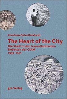
The Heart of the City. Die Stadt in den transatlantischen Debatten der CIAM 1933-1951
Zürich: gta Verlag. Mehr Die Congrès Internationaux d’Architecture Moderne (CIAM) verbreitete ihre Idee einer «Humanisierung der Stadt» durch Publikationen und eine intensive Korrespondenz bis über den Atlantik. Diesem transatlantischen Dialog und seinem Einfluss auf die städtebauliche Entwicklung Europas sowie die gesellschaftliche Erneuerung nach dem Krieg geht das Buch More
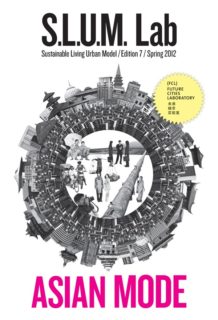
SLUM Lab: Asia Mode. Volume 7
Zurich: ETH Zurich, FCL Singapore. Mehr The magazine has grown to address a wide variety of global urban themes. Since its first edition, S.L.U.M. Lab has proven to be both provocative and popular. Knowledge sharing has always been a core aspect of the magazine, and many leading More
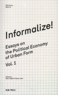
Informalize! On the Political Economy of Urban Form
Berlin: Ruby Press. Mehr A cross-section of urban informality drawing on broader theoretical frameworks as well as case studies. Reading the city of yesterday as the physical manifestation of the failure of the urban economy to meet the needs of a growing population, Informalize! turns to the city More
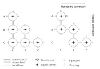
Comparison of Hierarchical Network Design Shape Grammars for Roads and Intersection
Paper to be presented at the 91th Annual Meeting of the Transportation Research Board, Washington, D.C.. January 2012. Mehr The paper elaborates on shape grammars, which describe in the form of rules how transport network elements are added to each other for network design. The impact of shape More
Dutch New Worlds: Scenarios in Physical Planning and Design in the Netherlands, 1970-2000
Rotterdam: 010 Publishers Rotterdam. Mehr Dutch New Worlds tells for the first time the story of how scenario thinking changed urbanism and physical planning, from its beginning in the late 1960s to its height in the 1990s. It shows how most grand scenario projects came to nothing because More
Stabil mobil: komplexe Verkehrssysteme als Herausforderung unserer Gesellschaft. Tagungsband: dritte internationale und interdisziplinäre Tagung im Rahmen der Reihe “Gesellschaft – Mobilität – Technik” von ETH und Universität Zürich
Zürich: ETH Zürich, IVT. Mehr Der Tagungsband beinhaltet alle Beiträge und zeigt, welche Synergien eine interdisziplinäre Debatte, die sich für verkehrswissenschaftlich, raumplanerisch und damit gesellschaftlich relevante Fragen interessiert, zwischen Hochschulen, staatlicher Verwaltung, öffentlichen und privaten Unternehmen hervorbringen kann.
Mobilitäts- und Transportplanung – Tägliche Flüsse: (M)ittel- und (L)angfristig
Modul VIII, Prof. Dr. Kay Axhausen Die Personen- und Warenflüsse auf verschiedenen Zeitskalen ermitteln, um sie im Kontext mittel- und langfristiger Entscheidungspolitik und Städteplanung zu bewältigen, zu planen und zu optimieren.
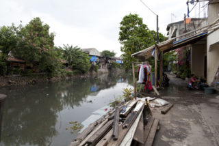
Landschaftsökologie – Ciliwung River und das Gestaltungspotential urbaner Peripherien
Modul VII, Prof. Christophe Girot Landschaftsgestaltung hydrologischer Ökosysteme an der Peripherie südostasiatischer Städte – das Wassereinzugsgebiet des Ciliwung zwischen Bogor and Jakarta als Fallbeispiel in Indonesien. Die Wechselwirkungen zwischen Wassersystemen, Ökologie und Landschaftsgestaltung in den wachsenden Metropolregionen Südostasiens untersuchen, um die Wasserqualität und Biodiversität mit Rücksicht auf lokal More
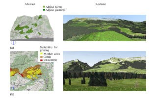
Which is the appropriate 3D visualization type for participatory landscape planning workshops? A portfolio of their effectiveness
In: Environment and Planning B, 38: 921-939. Mehr Mehr 3D visualizations have been implemented in workshops and analyzed with regard to their effectiveness as communication tools in planning processes. The results show that the different strengths of both abstract and realistic 3D visualization types are required in participatory workshops.
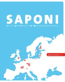
SAPONI – Spaces and Projects of National Importance
Zürich: vdf Hochschulverlag AG, ETH Zürich. Mehr Over a three years period a series of different symposia with high-level spatial planners from all over Europe had been focusing on strategic spaces and projects. The book sums up the findings of these issues which can have «far-reaching consequences and More
Entwicklung der technischen Nachhaltigkeit auf der Lötschberg- und Gotthardachse (1990-2010)
Working Paper de l’UIKB – n° 4. Zürich: ETH Zürich, IVT. In der Studie «Impact of market liberalization on the sustainability of network industries: a comparative analysis of the railways and civil aviation in Switzerland» wurde unter anderem untersucht, welche Auswirkungen die Liberalisierung im Eisenbahnwesen auf die Nachhaltigkeit More
Choosing carpooling or car sharing as a mode: Swiss stated choice experiments
Research Board. Washington, DC, January 2012. PDF A recent study aimed to estimate the potential of carpooling in Switzerland. Part of this study was a survey in which the attitude of the public towards this transport option was investigated using both multi-response questions and stated preference experiments.
Architecture Dialogues
Zürich: Verlag Niggli. Mehr In den vorliegenden «Architekturdialogen» befragen neun Interviewer 30 namhafte Schweizer Architekturschaffende nach Leitbildern, Tendenzen und einem Ausblick ihrer theoretischen Überlegungen und praktischen Arbeiten. Unter den Architekten und Büros sind Herzog & de Meuron, Peter Zumthor, Valerio Olgiati, Mario Botta, Luigi Snozzi und viele More
Mies als Gärtner. Pamphlet 14
Zürich: gta-Verlag. Mehr. Mit dem 14. «Pamphlet» wurde ein inhaltlich wie grafisch überarbeitetes Konzept präsentiert: gezielte thematische Schwerpunkte und fallweises Zusammenführen von Fachleuten aus verschiedenen Disziplinen und Hochschulen. Das aktuelle Heft lenkt den Blick auf den Architekten Mies van der Rohe. Sechs Aufsätze nehmen die Metapher «Mies als More
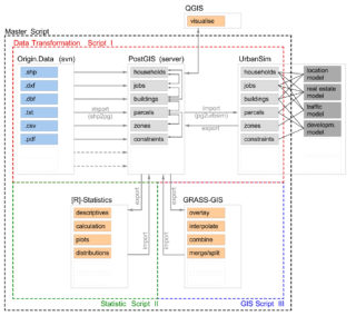
The Zurich case study of UrbanSim
Paper presented at 51th ERSA Conference, Barcelona, September 2011. PDF The paper describes the implementation work for a parcel based land use transport interaction model in the canton Zurich. The focus is on the challenges and solutions regarding data acquisition and preparation, which is an important issue regarding More
Strassenräume Berlin Shanghai Tokyo Zürich
Eine foto-ethnografische Untersuchung. Baden: Lars Müller Publishers. Mehr Der öffentliche Raum der Strasse muss den unterschiedlichsten gesellschaftlichen Gruppierungen grosse Möglichkeiten an Handlungen und Nutzungen gewähren und wird massgeblich durch diese mitgeprägt. In zahlreichen Fotobeobachtungen in Berlin, Shanghai, Tokyo und Zürich wurde ein umfangreicher Bildkatalog dieser Aktivitäten erstellt.
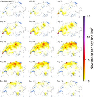
Reconstructing the 2003/2004 H3N2 influenza epidemic in Switzerland with a spatially explicit, individual-based model
BMC Infectious Diseases, 11, 115. PDF Wie kann man (Grippe)epidemien räumlich und zeitlich detailliert modellieren, wenn räumlich hoch aufgelöste Daten zum Verkehrsverhalten zur Verfügung stehen? Auf Grundlage der MATSim-Ergebnisse wurde die Wahrscheinlichkeit berechnet, wie häufig sich Personen von Tag zu Tag treffen. Die Übereinstimmung der Modellergebnisse mit der More
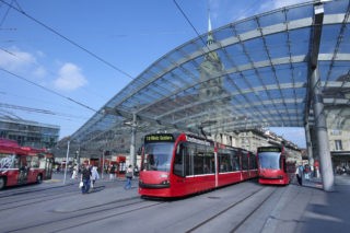
Überprüfung von Zweckmässigkeit und Kosten Tram Regio Bern
Gutachten an den Kanton Bern. Effretikon: Amt für öffentlichen Verkehr, ewp AG Effretikon und IVT, ETH Zürich. PDF Das Projektpaket Tram Region Bern wurde unter der Leitung von Prof. Ulrich Weidmann hinsichtlich Zweckmässigkeit und Kosten überprüft. Dabei konnte in Zusammenarbeit mit dem Ingenieurbüro ewp AG Effretikon der More
